Once you have uploaded a dataset to Mango you can add attributes to existing features, update geometry, or add new features.
Keeping your data up to date is simple with the feature edit tools available in the map editor.
The editing options are integrated into the feature popup for signed in users with appropriate permissions. You can edit attributes and geometry of features in layers in your maps.
Watch this quick video to see how it works
Accessing the edit tools
To access the editing tools, first open a map containing data you wish to edit.
Once the map is open, click on the feature you want to edit. The popup will appear, containing the data edit tools on the right hand side.
Note: Popups must be enabled for the layer you wish to edit to access the editor from the attribute popup.
Editor Functions
Edit Geometry
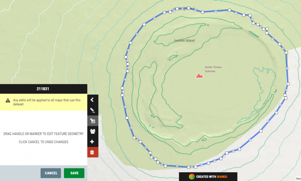
To edit the geometry of any polygon, point, or line, first select the feature by clicking on it. Once the feature has been selected, click the Edit geometry button on the upper right of the popup. The feature then becomes editable – indicated by the visible corner nodes. To modify geomery, click and drag the nodes for polygons and lines, or drag the marker for point data.
Once you finished editing the geometry, click the green SAVE button to commit the changes.
Note: the edit will be applied to all maps that are using this dataset as a layer.
If you wish to cancel changes without saving, click CANCEL.
Edit Attributes
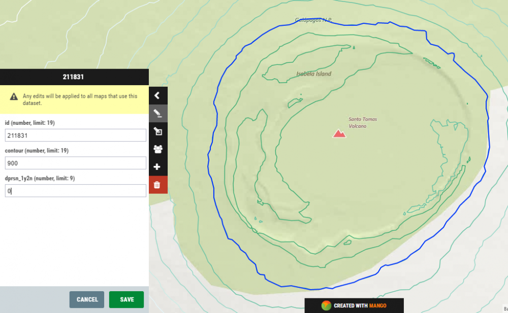
To edit feature attributes, click on the Edit attributes icon on the upper right of the popup window. This enables editing for all attribute fields for the feature, and displays the format of the field and the maximum length of the field. Supported field types for shapefiles are:
- floating point (13 character storage)
- integer (4 or 9 character storage)
- date (8 character storage)
- text (maximum 254 character storage)
Once you have editing attributes, click the green SAVE button to commit the changes.
Note: the edit will be applied to all maps that are using this dataset as a layer.
If you wish to cancel changes without saving, click CANCEL.
Deleting Features
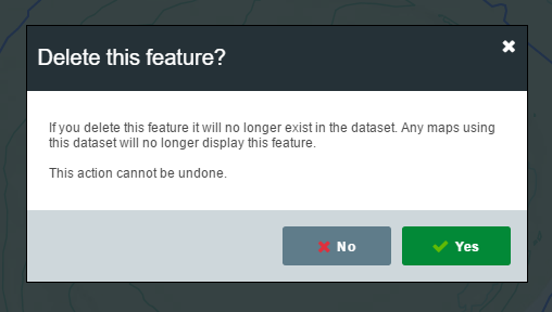
To delete a feature, first select it by clicking on the feature in the map. Once the popup has loaded, click the red Delete this feature icon on the lower right of the popup. A confirmation window will prompt you to confirm the action.
Editing Permissions
The Account Owner has permanent edit rights on all maps and data, regardless of who uploaded the data.
If you have Users & Groups, an Administrator who uploaded the data, or an Administrator or Data Editor in a Group with edit permissions for the dataset can edit, add and delete features in a dataset.
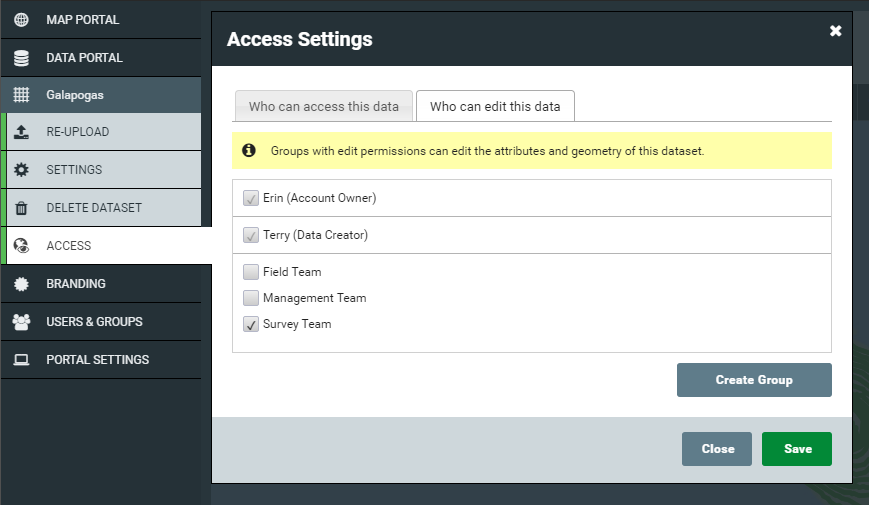
To assign edit permissions to a user, add their Group to the Edit permission list in the dataset. This can be accessed quickly from the map popup by clicking on the Edit permissions button.

This will take load the dataset settings page with the Access tab open. You will see a list of all Groups on your account. Check which Groups you want to provide Edit access, and click SAVE.
Editing field types is not possible in Mango
To change a field type, you must use a desktop GIS to add a new column of your desired field type with a unique field name.